The Road module is the basis for your entire asset management system and comes pre-populated with your agency’s GIS map. Inventory fields for road name, legal class and functional class all come pre-populated from information from the Michigan Framework Basemap which is updated annually.
Users can track data on physical features like pavement type, thickness, and lane and shoulder width. The Road module also allows user to track construction and maintenance history as well as historical pavement condition ratings. Roadsoft includes a pavement deterioration model that uses maintenance and condition data to predict future condition, and a project planning utility to schedule and plan future maintenance activity.
Information tracked using the Road Module includes:
- Number of lanes
- Surface width
- Surface type and sub-types
- Function class
- Rural-urban designation
- PASER Ratings
- Maintenance history
- Construciton history
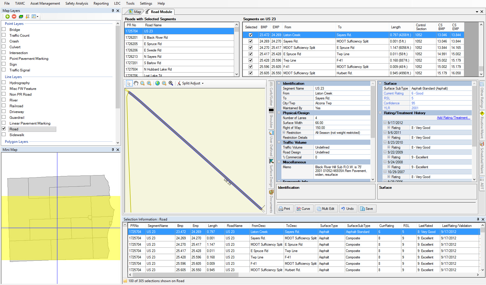
The Inventory tab of the Road Module records the physical characteristics of roads including shoulders, curbs, gutters, and traffic counts. The Rating Segment tab records rating and construction history of roads
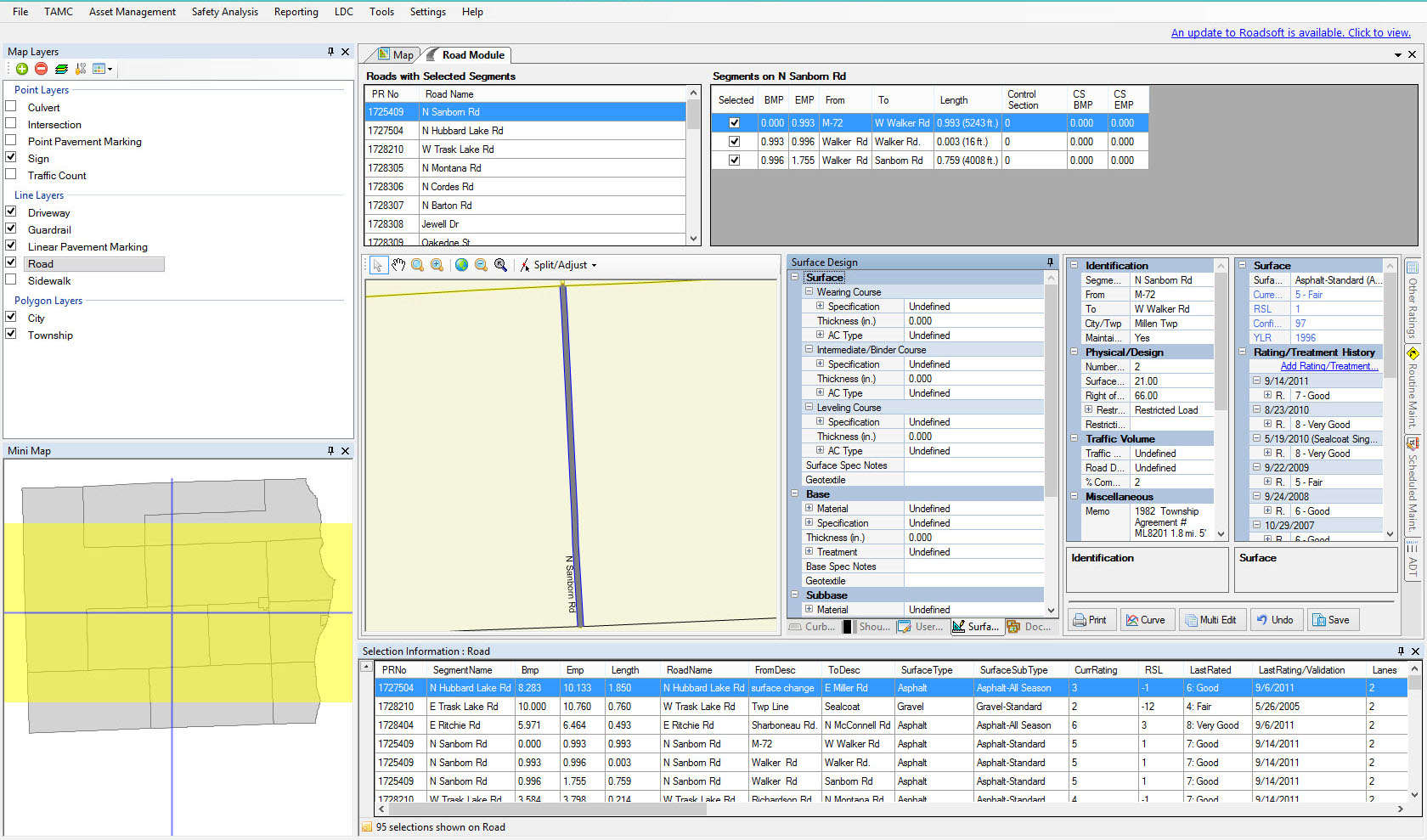
The Surface Design tab of the Road Module contains the physical characteristics of each layer of the road segment
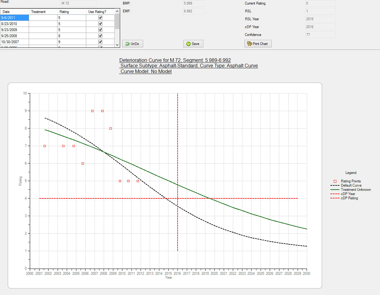
A pavement deterioration model is used to predict how various treatment options will extend pavement life